🛢️Pipeline & Oil/Gas
Pipeline Grade Documentation Software — PHMSA Compliance and ROW As-Built
Log station-based grade shots, depth of cover checks, and HDD bore records for PHMSA-compliant pipeline documentation and right-of-way as-built surveys.
The Problem
!
PHMSA documentation requirements are extensive
Pipeline contractors must document depth of cover, grade, and bore records at every station. Paper-based systems create compliance gaps that regulators flag during audits.
!
Depth of cover verification is slow and error-prone
Verifying minimum cover requirements at hundreds of stations — and logging each — takes an entire crew day when done manually.
!
HDD bore records scattered across crews
Horizontal directional drilling bore logs, soil conditions, and crossing records are kept by individual crews and never consolidated into a single project record.
How Sitemark Solves It
Built for Pipeline & Oil/Gas Contractors
✓
Station-Based Shot Entry
Log grade checks in 0+00 station format with automatic decimal conversion — standard for all pipeline ROW documentation.
✓
Depth of Cover Logger
Log top-of-pipe elevation and ground surface elevation at every station — cover in inches auto-calculated with pass/fail vs minimum requirement.
✓
HDD Bore Log
Complete horizontal directional drilling documentation — entry/exit elevations, bore depth profile, soil conditions, and pipe specs per crossing.
✓
Linear Route Progress Tracker
Daily production log by station range — track footage installed vs total project length.
✓
ROW As-Built Generation
Station-based as-built report with grade, cover, and bore records for PHMSA and regulatory submittal.
✓
GPS Location Capture
Capture GPS coordinates at each station check — exportable as KMZ/CSV for GIS records.
Equipment
Top Equipment for Pipeline & Oil/Gas
Shop all at Express Tools ↗Trimble
Best Kit
Trimble
R12i GNSS Receiver
$18,000Shop at ET →
Leica
Leica
GS18 T GNSS Smart Antenna
$18,000Shop at ET →
Topcon
Topcon
HiPer HR GNSS Receiver
$15,000Shop at ET →
Sokkia
Sokkia
GRX3 GNSS Receiver
$8,500Shop at ET →
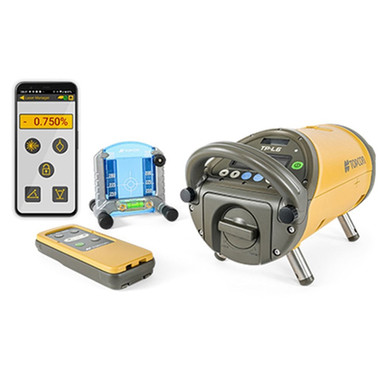
Topcon
TP-L6GV Pipe Laser Package
$6,295Shop at ET →
Trimble
Trimble
TSC7 Data Collector
$3,800Shop at ET →
Free Tools
Free Pipeline & Oil/Gas Calculators
Pipe Grade Calculator
Calculate required grade % from invert elevations
Use calculator →
Horizontal Bore Calculator
HDD bore depth profile from entry/exit elevations and angles
Use calculator →
Invert Elevation Calculator
Calculate ending invert from grade, length, and starting invert
Use calculator →
Trench Volume Calculator
Excavation volume for trapezoidal trench cross-sections
Use calculator →
Standards & Compliance
Compliance Sitemark Helps You Document
PHMSA 49 CFR 192/195
Federal pipeline safety regulations requiring depth of cover documentation, cathodic protection records, and as-built surveys.
API 1110
American Petroleum Institute standard for pressure testing and pipeline commissioning documentation.
Minimum Cover Requirements
PHMSA requires 30 inches minimum cover in normal areas, 36 inches under drainage ditches, 48 inches under roads and railroads.
HDD Documentation
Horizontal directional drills require bore logs, soil condition records, and pressure records for regulatory files.
FAQ
What documentation does PHMSA require for pipeline construction?
PHMSA requires construction records including depth of cover measurements, material certifications, weld records, inspection reports, and as-built surveys. Sitemark covers the field documentation portion — grade shots, depth of cover logs, bore records, and daily inspection notes — in a format suitable for the project quality record.
How does Sitemark handle depth of cover verification?
The depth of cover module logs top-of-pipe elevation, ground surface elevation, minimum required cover, and auto-calculates actual cover in inches with pass/fail status. You can export all depth of cover records by station range for PHMSA compliance files.
Can Sitemark log HDD bore crossings?
Yes. The bore log captures bore ID, start and end stations, entry and exit elevations, bore depth profile, pipe type and size, soil conditions, and obstructions encountered. One bore log per crossing, linked to the job and exportable as part of the project as-built.
What GPS accuracy is needed for pipeline surveys?
Pipeline centerline surveys typically require horizontal accuracy of ±0.1 ft and vertical accuracy of ±0.3 ft for general ROW documentation. For depth of cover verification, you need ±0.05 ft vertical to reliably detect marginal cover situations. RTK GPS receivers from Trimble, Leica, or Topcon meet these requirements.
Does Sitemark replace a licensed survey?
Sitemark generates field documentation records, not a licensed survey. For projects requiring a PE-stamped or licensed pipeline survey, you need a licensed professional. However, Sitemark's data significantly reduces the time a surveyor needs because all field measurements are already organized and accurate.
Ready to modernize your pipeline & oil/gas documentation?
Join contractors using Sitemark to replace paper logs, pass inspections faster, and generate professional as-built reports in seconds.
14-day free trial · No credit card · Field Pro from $19/mo